The instrument returns
After the 2008 crash, contract-for-deed selling returned to Black neighborhoods; reporting traced it across Chicago by 2016.
Hyde Park, Chicago, 1832 to 2026
Federal surveyors finished this map of Chicago in 1940. It graded the city’s neighborhoods for mortgage lenders, A down to D, and the Black Belt runs through its middle in red.
A ten-minute walk down one century, on one map. Every figure carries its source, one tap away.
Chapter 1 of 13 · 1940
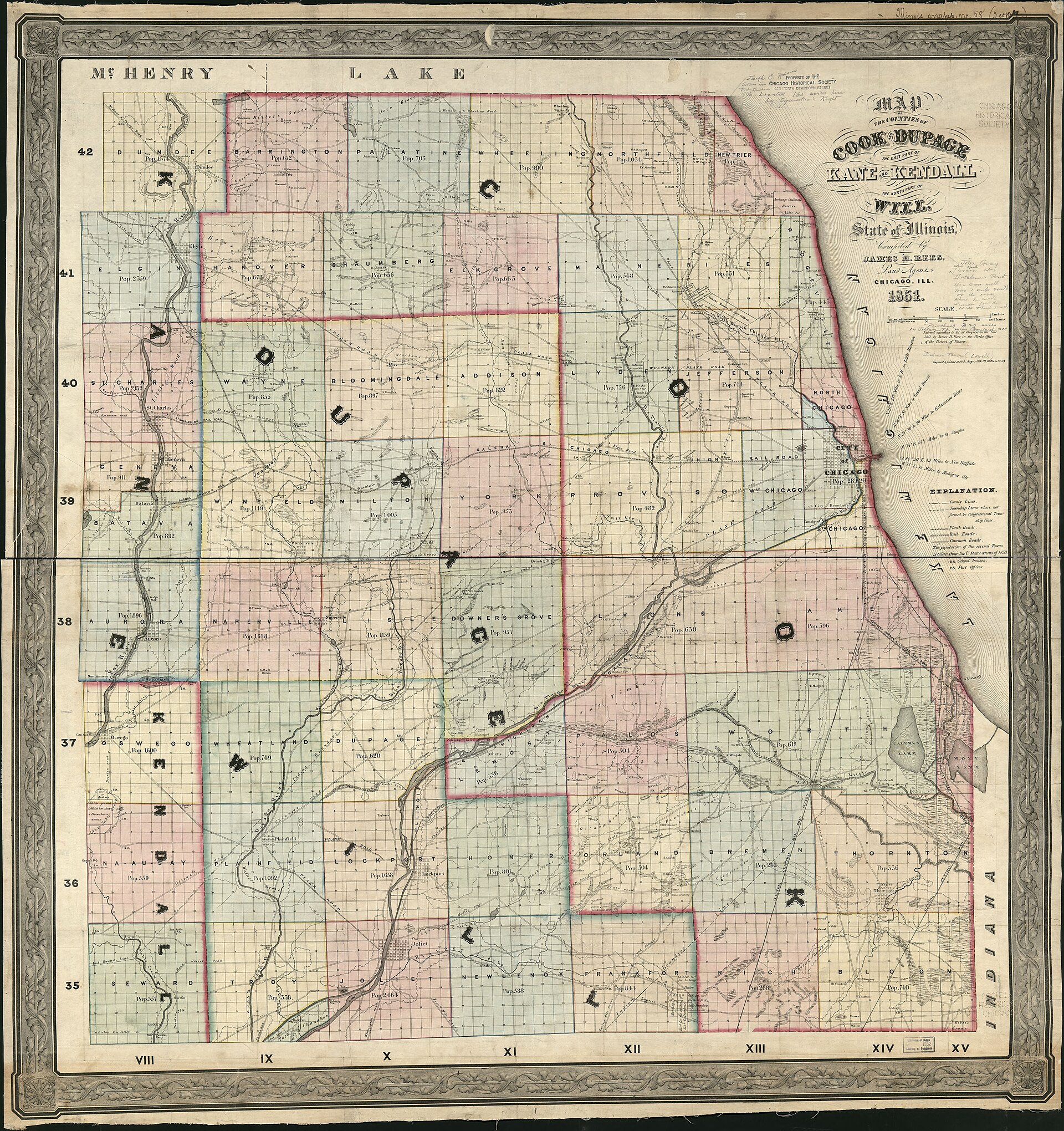
Chapter 2 of 13 · 1832 to 1889
Posted to the ledger. 1833, Potawatomi land ceded under force.
Chapter 3 of 13 · 1893
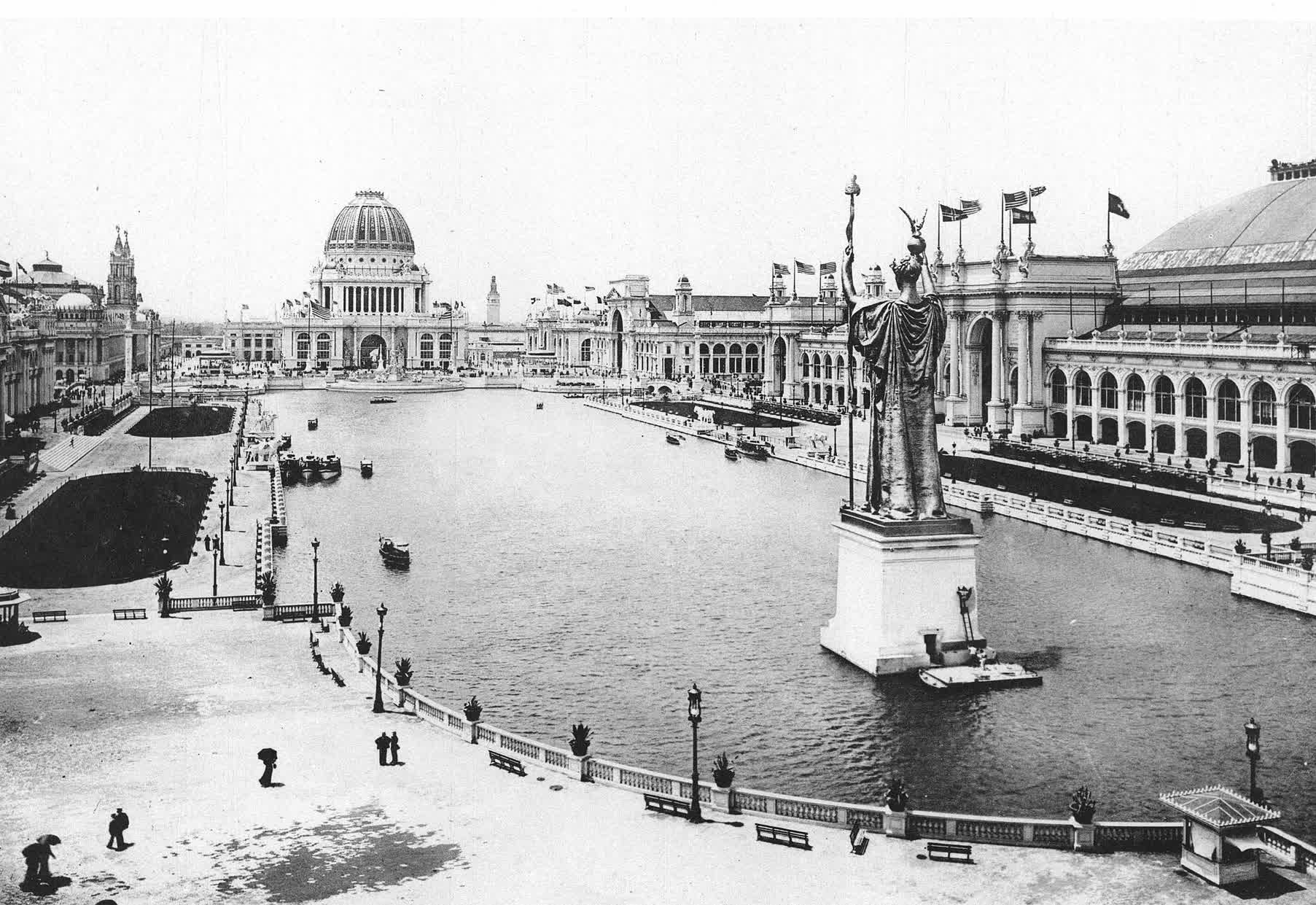
Posted to the ledger. 1893, Housing stock built for a six-month fair.
At the fair itself, in her own words
“The exhibit of the progress made by a race in 25 years of freedom as against 250 years of slavery, would have been the greatest tribute to the greatness and progressiveness of American institutions which could have been shown the world.”
Ida B. Wells
1862 to 1931
Preface, The Reason Why the Colored American Is Not in the World’s Columbian Exposition, 1893
Chapter 4 of 13 · 1921 to 1970
Taken together the five spans cover 1921 to now with no year uncovered. The solid band marks 1921 to 1970, when no year passed with every instrument off. An open band continues from 1970 to now, because urban renewal never switched off.
From 1921 to 1970 there was no year the machinery was off. When a court closed one instrument, another was already running.
Chapter 5 of 13 · 1908 to 1917
Posted to the ledger. 1908, A neighborhood organizes to remove its neighbors.
Chapter 6 of 13 · 1917 to 1921
From July 1917 to March 1921 the commission recorded 58 bombings. Its report documents 40 of them one by one, and this table holds all 40. The map can place 32, 24 at a street address and 8 at a block. Across all 58 the record shows 2 arrests. No convictions.
The commission measured the pace itself, an average of one race bombing every twenty days for three years and eight months.
The dashed square on the map is the commission’s own. Thirty-two of the fifty-eight bombs fell within the square bounded by Forty-first and Sixtieth streets, Cottage Grove Avenue and State Street.
| Date | Target | Conviction |
|---|---|---|
| July 1, 1917 | S. P. Motley home5230 Maryland Ave | No conviction recorded. |
| About May 25, 1918 | Building occupied by Black families4529 Vincennes Ave | No conviction recorded. |
| Before 1919 | Property held by Black real estate agentsBerkeley Ave just north of 43rd St | No conviction recorded. |
| Before 1919 | Property held by Black real estate agentsBerkeley Ave just north of 43rd Stsecond attack here | No conviction recorded. |
| Before 1919 | Buildings in the 4500 block of Vincennes Ave4500 block Vincennes Ave | No conviction recorded. |
| Before 1919 | Buildings in the 4500 block of Vincennes Ave4500 block Vincennes Avesecond attack here | No conviction recorded. |
| Before 1919 | Buildings in the 4500 block of Vincennes Ave4500 block Vincennes Avethird attack here | No conviction recorded. |
| Before 1919 | Buildings in the 4500 block of Vincennes Ave4500 block Vincennes Avefourth attack here | No conviction recorded. |
| Before 1919 | Property at 4200 Wabash Ave | No conviction recorded. |
| Before 1919 | Property at 4200 Wabash Avesecond attack here | No conviction recorded. |
| Before 1919 | Property at 4732 Indiana Ave | No conviction recorded. |
| January 1919 | Black real estate agentNo address recorded | No conviction recorded. |
| January 1919 | White real estate agentNo address recorded | No conviction recorded. |
| March 1919 | Jesse Binga real estate office4724 State St | No conviction recorded. |
| March 1919 | Apartment building4041 Calumet Ave | No conviction recorded. |
| April 1919 | Wimes & Lassiter, Black real estate dealers4722 Indiana Ave | No conviction recorded. |
| About April 7, 1919 | Flat building occupied by Black families4212 Ellis Ave | No conviction recorded. |
| May 1, 1919 | Building occupied by Black residents3365 Indiana AveA six-year-old child was killed here. | No conviction recorded. |
| May 17, 1919 | Mrs. Gertrude Harrison home4708 Grand Blvd | No conviction recorded. |
| May 18, 1919 | Mrs. Gertrude Harrison home4708 Grand Blvdsecond attack here | No conviction recorded. |
| June 4, 1919 | House adjacent to the Motley homehouse adjacent to 5230 Maryland Ave | No conviction recorded. |
| November 12, 1919 | Jesse Binga real estate office4724 State Stsecond attack here | No conviction recorded. |
| About December 3, 1919 | Jesse Binga residence5922 South Park Ave | No conviction recorded. |
| December 26, 1919 | J. H. Coleman homeNo address recorded | No conviction recorded. |
| December 27, 1919 | Jesse Binga residence5922 South Park Avesecond attack here | No conviction recorded. |
| January 5, 1920 | Mrs. Mary Byron Clarke home4404-4406 Grand Blvd | No conviction recorded. |
| January 6, 1920 | W. B. Austin homeNorth Side | No conviction recorded. |
| February 1920 | Building recently sold to the Appomattox ClubNo address recorded | No conviction recorded. |
| February 1, 1920 | R. W. Woodfolk flat building4722 Calumet Ave | No conviction recorded. |
| February 12, 1920 | Mrs. Mary Byron Clarke home4404-4406 Grand Blvdsecond attack here | No conviction recorded. |
| February 28, 1920 | Jesse Binga residence5922 South Park Avethird attack here | No conviction recorded. |
| About March 5, 1920 | George A. Hyers propertyNo address recorded | No conviction recorded. |
| March 10, 1920 | Moses Fox home442 E 45th St | No conviction recorded. |
| About April 3, 1920 | Four-story flat building owned by Robert B. Jackson423 E 48th Pl | No conviction recorded. |
| April 13, 1920 | Mrs. Mary Byron Clarke home4404-4406 Grand Blvdthird attack here | No conviction recorded. |
| April 25, 1920 | Crede Hubbard three-flat building4331 Vincennes Ave | No conviction recorded. |
| May 1920 | Clubhouse of a Black club of 600 membersNo address recorded | No conviction recorded. |
| June 18, 1920 | Jesse Binga residence5922 South Park Avefourth attack here | No conviction recorded. |
| November 23, 1920 | Jesse Binga residence5922 South Park Avefifth attack here | No conviction recorded. |
| February 1921 | Three-story apartment buildingNo address recorded | No conviction recorded. |
| Totals for the full survey period.58 bombings, July 1917 to March 19212 killed, both Black0 convictions | ||
The record counts the dead. It names neither; one was a child of six.
The commission recorded the answer the bombing years got. “Only two of the forty Negro families bombed have moved; the others have made repairs, secured private watchmen or themselves kept vigil for night bombers, and still occupy the properties.”
Posted to the ledger. 1919, Dead in the riot, families burned out.
Chapter 7 of 13 · 1921 to 1947
The realtors’ rule, quoted in full
“A Realtor should never be instrumental in introducing into a neighborhood a character of property or occupancy, members of any race or nationality, or any individuals whose presence will clearly be detrimental to property values in that neighborhood.”
Restrictive agreement, printed form
the model’s terms, described, not quotedA clause in the title barring sale or rental to anyone who was not white, binding every future owner.
Whoever owned the lot could not sell it, lease it, or rent it to anyone who was not white. The promise bound the next owner, and every owner after that, and any neighbor could go to court to enforce it.
Posted to the ledger. 1927, Covenants spread across Cook County.
Chapter 8 of 13 · 1933 to 1940
The sheets behind the grades
Each grade on this map rests on a form a federal surveyor filed. Here is what two of those forms say, word for word.
Grade A, best
Sheet A11
The surveyor lists the restriction among the merits of the best grade.
Read the full sheet in the study roomGrade D, hazardous
Sheet D106
On the lowest grade, the surveyor’s “so far” treats restriction as the expected condition.
Read the full sheet in the study roomAcross all 576 sheets
The pattern holds across the whole survey.
Tap any area of the map for the sheet behind its grade, or choose an area below.
Posted to the ledger. 1939, Graded hazardous. The manual scores race as risk.
Chapter 9 of 13 · 1937 to 1948
The red line is the practice of exclusion. Where a ruling barred one lane, the practice turned into the next.
Open any ruling below
Solid bars mark rulings that closed a lane. The split bar marks the crack.
Open any ruling below
Hansberry v. Lee
311 U.S. 32 · 1940
The holding
The earlier covenant judgment does not bind the Hansberrys, who were never represented in that case.
The consequence
A Chicago family wins on procedure. The gate cracks but stands.
6140 South Rhodes Avenue
The Hansberrys moved here in 1937, inside covenanted territory. One of the children in the house was seven-year-old Lorraine.
in summaryShe was a child when her family moved into covenanted territory near Washington Park and a mob gathered outside. She grew up to put the memory on stage in A Raisin in the Sun.
Lorraine Hansberry1930 to 1965
Playwright; the child in the house behind Hansberry v. Lee
To Be Young, Gifted and Black, 1969; Hansberry v. Lee, 311 U.S. 32
Posted to the ledger. 1948, Covenants ruled unenforceable.
Chapter 10 of 13 · 1949 to 1963
The same ground, two states
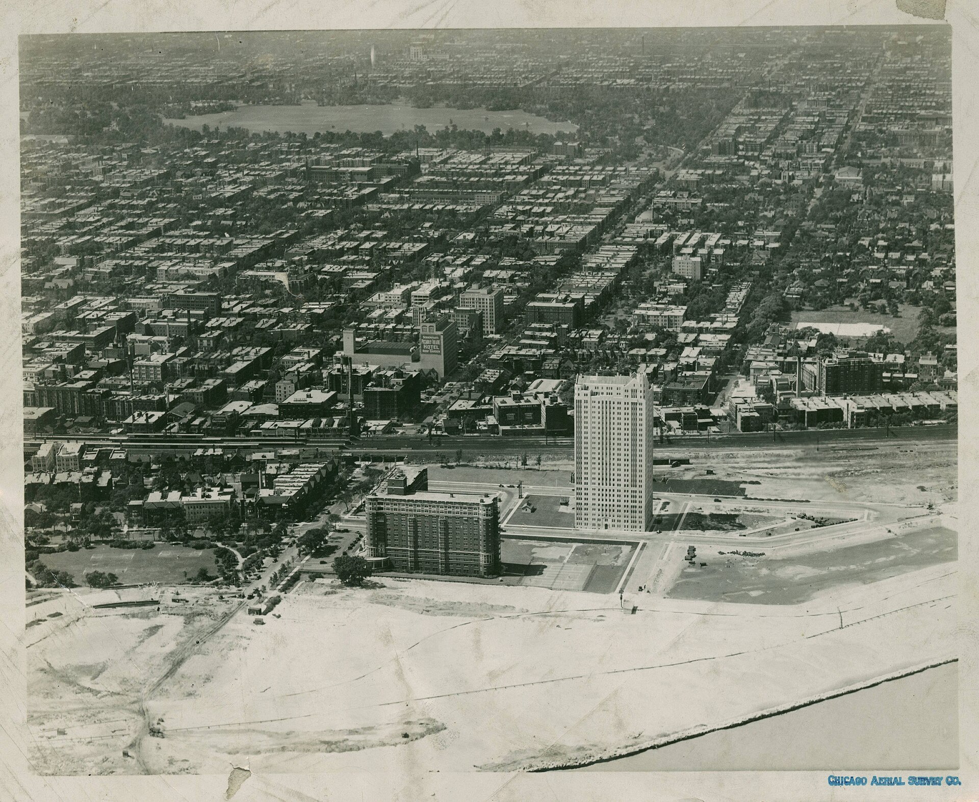
The plan the council approved marked 638 buildings for demolition on this ground.
One mark, one family
One square is one displaced family. About 4,000, an estimate.
About 4,000 familiesreported were moved off the renewal ground over the course of the program. Each square above marks one household once.
Posted to the ledger. 1962, Families removed by the renewal.
In his own words
“urban renewal, which means moving the Negroes out… it means Negro removal, that is what it means”
Chapter 11 of 13 · 1952 to 1970
Both families buy the same house on the same day. One carries a federally insured mortgage. One signs a land contract. The columns count what each pays beyond a fair price, in the study’s 2019 dollars.
The mortgage buyer
$0
beyond a fair price
The contract buyer
$71,027
beyond a fair price
The study’s average, about $71,000 more for the same house. 121 months at $587 more is $71,027.
The track ends where the extra payments reach the study’s average.
The figure is the study’s average loss per contract-buying family, in 2019 dollars. The study found an 84 percent average markupreported over what sellers had just paid for the same houses.
The worked example
More than double what the seller had paid, months apart, for the same house. His case ran worse than the study’s average.
Chapter 12 of 13 · 1968 to 1971
The one warm room
January 1968, a church basement in North Lawndale. Neighbors who had bought on contract began reading their agreements to each other and heard the same terms on every page. They organized as the Contract Buyers League.
When the neighbors compared their contracts, she was among the first to stand and read hers out loud. The league that followed renegotiated contract after contract at fair value.
Ruth WellsContract Buyers League, 1968 to 1971
Among the first to stand up in the church basement and say what she had paid
Satter, Family Properties, 2009, Contract Buyers League chapters
He came north from Mississippi, bought on contract at twenty-seven thousand five hundred dollars for a house the seller had bought at twelve thousand, and spent years organizing so the next family would know the trap.
Clyde Ross1923 to 2021
Contract buyer in North Lawndale, Contract Buyers League organizer
Coates, The Case for Reparations, The Atlantic, 2014
The record, one line
The strike had a price.
Two years before the basement filled, King had taken a flat in the same neighborhood.
He took a North Lawndale flat in January 1966 to make Chicago’s housing the movement’s northern front. The marches he led into all-white neighborhoods that summer put open housing on the national agenda, and the Fair Housing Act followed in 1968.
Martin Luther King Jr.1929 to 1968
Brought the movement to Chicago’s housing in 1966
Chicago Magazine, August 2016; Fair Housing Act, 1968
Posted to the ledger. 1958, The color tax per contract-buying family.
Posted to the ledger. 1971, Contract Buyers League renegotiations.
Chapter 13 of 13 · 1971 to 2026
Say the story ended in 1970, two generations back. The record since then answers on its own.
The account · 1833 to 2026
Dollars of their year. Entries do not sum.
| Year | Entry | Amount |
|---|---|---|
| 1833 | Potawatomi land ceded under force | |
| 1893 | Housing stock built for a six-month fair | |
| 1908 | A neighborhood organizes to remove its neighbors | |
| 1919 | Dead in the riot, families burned out | 38 deadabout 1,000 burned out |
| 1927 | Covenants spread across Cook County | |
| 1939 | Graded hazardous. The manual scores race as risk | |
| 1948 | Covenants ruled unenforceable | |
| 1958 | The color tax per contract-buying family | $71,000per family2019 dollars |
| 1962 | Families removed by the renewal | |
| 1971 | Contract Buyers League renegotiationscredit | $14,000per contract |
| 2026 | The century’s bill, still outstanding | $3.2 to $4billion2019 dollars$285,010against $44,8902022 national medians |
Posted to the ledger. 2026, The century’s bill, still outstanding.
both start here, at zero
Black median$44,890
white median$285,010
twice the Black median
three times the Black median
four times the Black median
five times the Black median
six times, and still going
Both columns, one frame
Median family wealth nationwide, the 2022 survey.
One question is still open, the one the surveyors answered about every block on this map.
Uses your device location once, with your permission. Nothing leaves this page.
The exhibit ends on a question
Who is this ground for, and who decides?
Answers appear here once the first ones clear review.
Colophon
The Ground Keeps Moving
1832 to 2026
127 registered facts · 71 works and records
rooted-forward.org
Every figure in this exhibit resolves to a registered fact with a named source. The full record, the surveyors’ sheets included, is one door away.
The source record
The 127 facts rest on 71 works and records, alphabetized.
Polygons and area descriptions from Mapping Inequality (Robert K. Nelson, LaDale Winling, et al., University of Richmond Digital Scholarship Lab), CC BY-NC 4.0. Underlying HOLC records are public domain.
The map’s ground layers are drawn from the City of Chicago community area boundaries and the Chicago Park District park boundaries, both from the City of Chicago Data Portal, and from the U.S. Census Bureau’s TIGER/Line 2023 files (public domain), which carry the streets, the municipal landmass, Lake Michigan, the Chicago River, and the canals. The far water beyond the county line is filled from the eastern edge of the recorded polygons. The mile section grid follows the street-grid arithmetic documented in this exhibit’s bombing geocoding notes.